

CUHK
News Centre
CUHK Professor Detects the Amount of Water Entering the Earth’s Interior through Southern Mariana Trench for the First Time
Professor Hongfeng YANG at the Earth System Science Programme of The Chinese University of Hong Kong (ESSC, CUHK) has recently conducted a comprehensive study of the high-resolution structure and earthquakes near the Challenger Deep, the deepest spot on the Earth. The results showed for the first time how much water is carried into subduction zones in southern Mariana. Since the subducting plate is the primary channel from which water can enter the Earth’s interior, estimating the amount of water carried into the subduction zone plays an important role in the global water and material cycle. The article has been published in Geophysical Research Letters.
The Challenger Deep has attracted an enormous amount of attention from scientific investigators and explorers during recent decades. However, it remains mysterious in many aspects because no observations were made at a close distance due to the extreme water depth, 10.9 km. In addition, the scythe-shaped Mariana subduction zone formed by the Pacific plate subducting beneath the Philippine Sea plate features many special characteristics for which scientists have long sought explanations, such as the old and steep subducting slab, the lack of great earthquakes, and widespread mud volcanos.
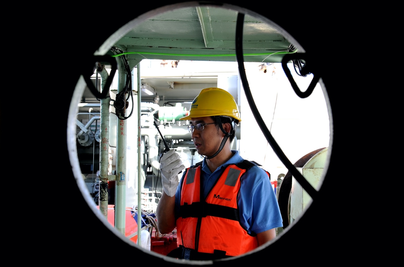
To unlock the mysteries of the deep ocean, Professor YANG collaborated with an international team to conduct expeditions to southern Mariana, in which a variety of multidisciplinary experiments, including physical oceanography, sediment sampling, gravity and magnetic measurements, and active-source and passive-source Ocean Bottom Seismograph (OBS) experiments have been carried out. In particular, OBS can record vibrations caused by earthquakes, which can be used to decipher the subsurface structure and process. The data in the study was recorded by tens of China-made OBS instruments, which were, for the first time, placed on the seafloor near the Challenger Deep in late 2016 and recovered half a year later (Figure 1).
Dr. Gaohua Zhu, a postdoctoral researcher in Professor Yang’s group and the leading author of the article, utilised passive-source OBSs data from earthquakes and ambient noise to image subsurface seismic structures of southern Mariana. The seismic velocity model demonstrates clear low-velocity anomalies within the upper ~25 km mantle near the trench, suggesting a large amount of water input in southern Mariana and a water-rich Mariana system. Under certain temperature and pressure conditions, seawater interacts with rocks to form hydrous minerals that lock the water into the rock. The extensional faults within the downgoing plate promote the hydration process and provide an important pathway to transport water into the Earth (Figure 2). As the sea level of the Earth has remained relatively stable, the water going into the Earth must be cycled back to the atmosphere and the ocean, normally via volcanic eruptions. However, in contrast to central Mariana where a series of volcanoes were formed, there was no mature volcano in southern Mariana. The large amount of input water is likely carried into deeper parts of the Earth and thus affects material composition and recycle at greater depths.
The project benefited from collaboration with the South China Sea Institute of Oceanology and the Institute of Geology and Geophysics, Chinese Academy of Sciences, as well as Washington University in Saint Louis. It also received funding from the Hong Kong Research Grant Council. In addition to Mariana, Professor Yang also worked on Makran, Cascadia, and Central America subduction zones. In 2018, he sailed on an expedition to the Makran Trench, Pakistan, investigating the potential for large earthquakes and devastating tsunami.
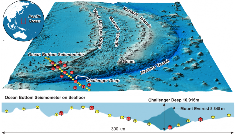
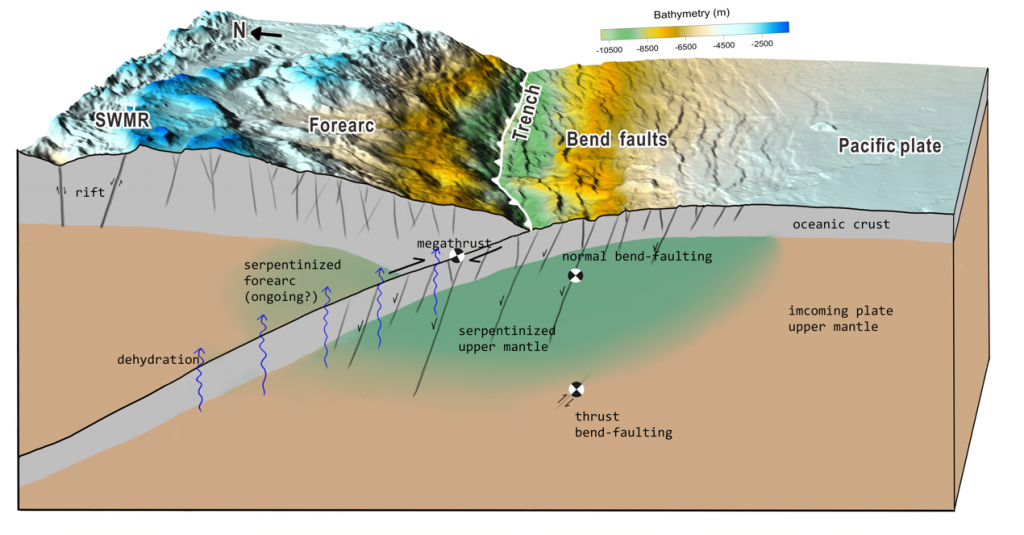


Figure 1: The data in the study was recorded by tens of China-made OBS instruments, which were, for the first time, placed on the seafloor near the Challenger Deep in late 2016 and recovered half a year later.
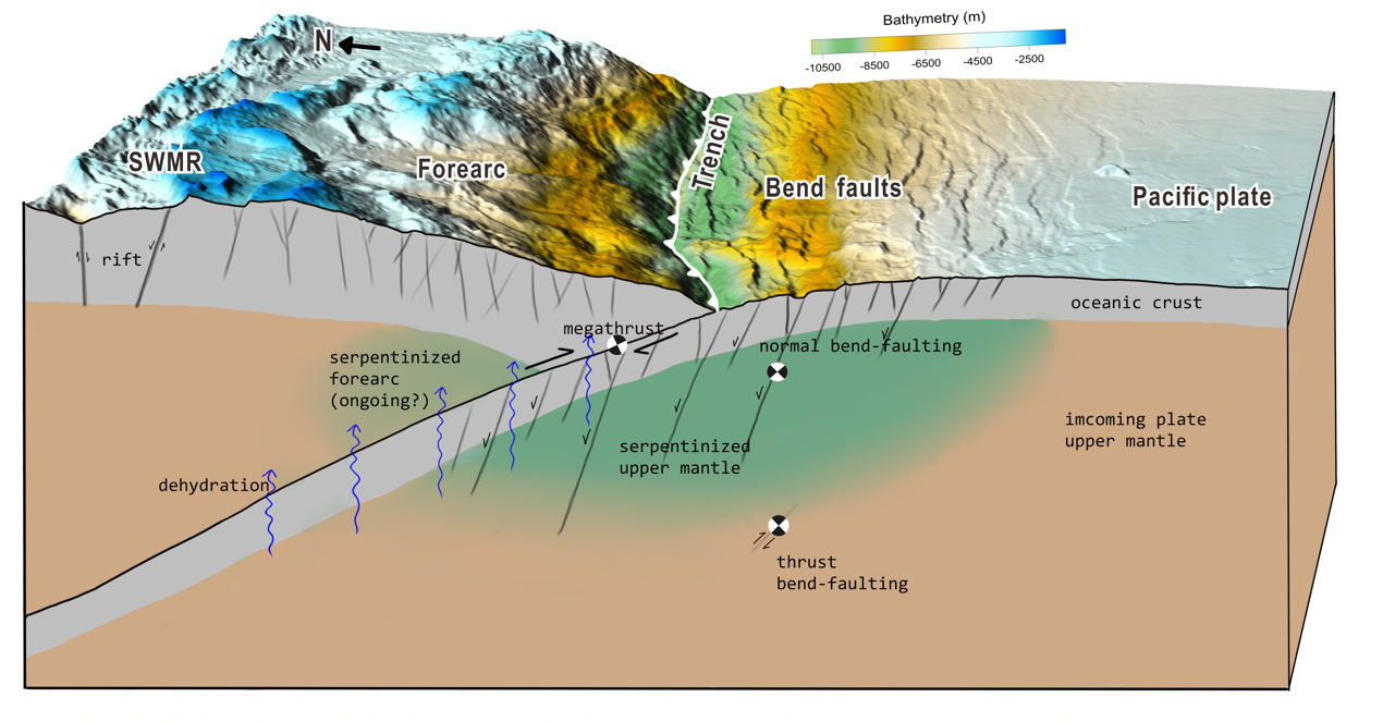
Figure 2: Pervasive faults within the Pacific plate are generated by plate bending before it is subducted, providing pathways to transport water into the Earth. Under certain temperature and pressure conditions, seawater interacts with rocks to form hydrous minerals (green area: serpentinized upper mantle) that lock the water into the rock. Then the water is carried into the subduction zone by the downgoing plate and some of it may be released by the dehydration process.
In 2018, Professor Hongfeng Yang on the first China-Pakistan Joint Expedition to investigate potential earthquakes and tsunami along the Makran Trench in the Indian Ocean.
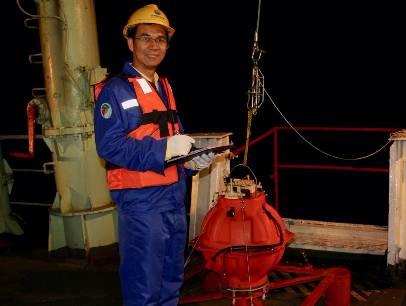
Professor Hongfeng Yang with an Ocean Bottom Seismometer during the first China-Pakistan Joint Expedition in 2018 to investigate potential earthquakes and tsunami along the Makran Trench in the Indian Ocean.