

CUHK
News Centre
CUHK Institute of Space and Earth Information Science Reveals 80% of Buildings were Damaged in Yushu
After the Yushu earthquake, the Institute of Space and Earth Information Science (ISEIS) and the Yuen Yuen Research Centre for Satellite Remote Sensing of The Chinese University of Hong Kong (CUHK) jointly conducted an analysis of building damage in Yushu, where multi-temporal and multi-sensor images were compared with aerial photos [sources: NASA, ESA, JAXA, GoogleMap, and Centre for Earth Observation and Digital Earth, Chinese Academy of Sciences (CAS)].
Prof. Zhang Yuanzhi, Assistant Professor, ISEIS said, ‘According to the preliminary results, it is found that about 80% of the buildings were damaged in the quake-hit area, and more than 60% of the buildings had collapsed, though there are no obvious earthquake-induced hazards such as land slides and/or mud-rock flow etc. ISEIS will continue to assess the damage of the Yushu earthquake through its remote sensing monitoring system. It also plans to conduct joint research with its mainland counterparts.’
ISEIS was established in 2005 on the basis of the Joint Laboratory for Geoinformation Science (JLGIS) of CAS and CUHK. As the only national base for satellite remote sensing in Hong Kong, the Institute is equipped with a middle-high resolution satellite remote sensing ground receiving station, which provides researchers and students a unique opportunity to carry out earth observation-related activities. ISEIS's main research areas include cloud-prone and rainy-areas remote sensing (CARRS), virtual geographic environments (VGE), emergency response and natural disaster monitoring and management, urban and metropolitan geographic information systems (GIS), analysis and modelling of urban settlement environments, public health and GIS, intelligent transport system (ITS), and spatially integrated humanities and social science.
ISEIS has received numerous international recognitions over the years for its outstanding research work. In 2009, CUHK joined the Universities Space Research Association (USRA) as its first Asian member among other world-renowned universities such as Harvard, Yale, Stanford, and Princeton.
Sources:
1. Landsat TM – before earthquake images from the Centre for Earth Observation and Digital Earth, CAS: http://www.ceode.cas.cn/xwdt/ttxw/201004/t20100414_2821292.html
2. Landsat TM – after earthquake images from the Centre for Earth Observation and Digital Earth, CAS: http://www.ceode.cas.cn/xwdt/ttxw/201004/t20100416_2824609.html
3. SPOT images from JAXA: http://www.eorc.jaxa.jp/ALOS/img_up/jdis_opt_china_eq2010_01.htm
4. Aerial photos from the Centre for Earth Observation and Digital Earth, CAS: http://www.ceode.cas.cn/xwdt/ttxw/201004/t20100417_2824634.html
5. GoogleMap images from Google earth of Google Corporation
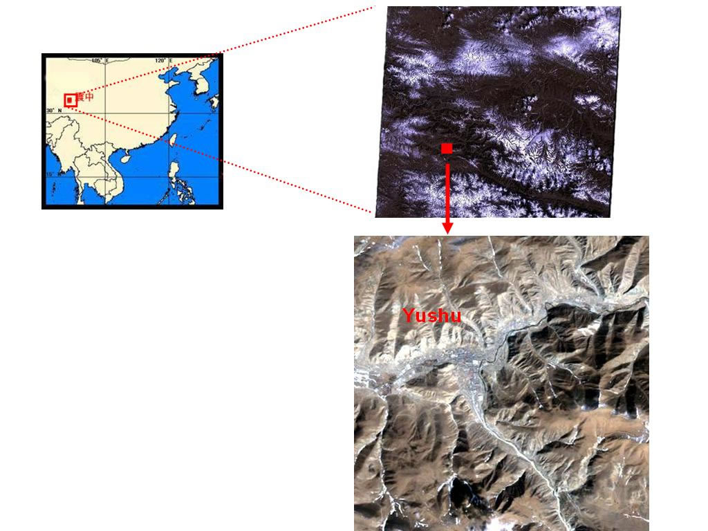
Yushu, Qinghai (Landsat TM 30-m, 26 February 2010)
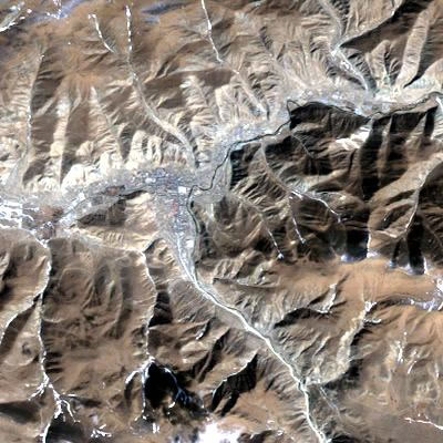
Yushu – before earthquake (Landsat TM, 26 February 2010)
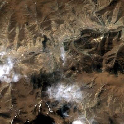
Yushu - after earthquake (Landsat TM, 15 April 2010)
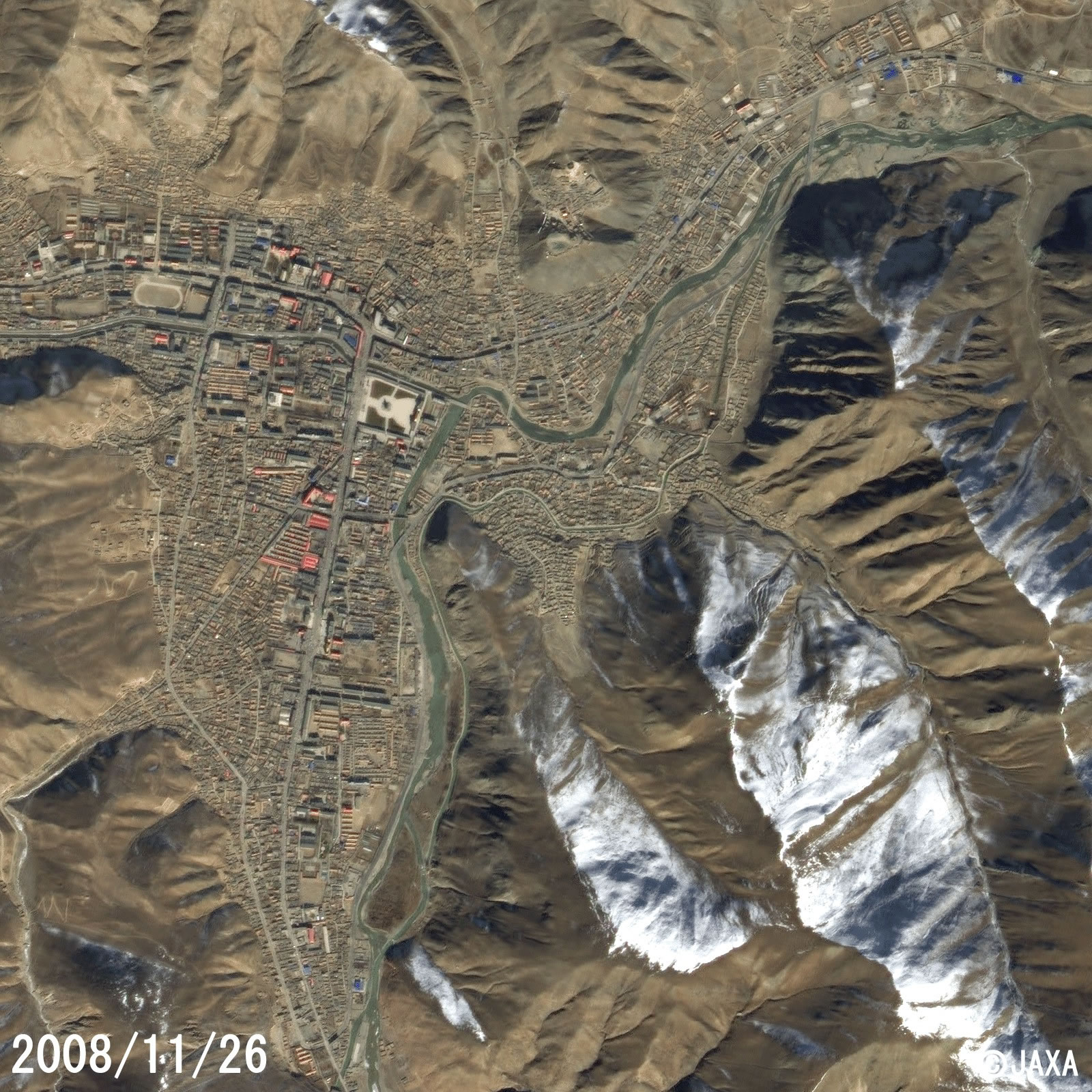
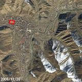
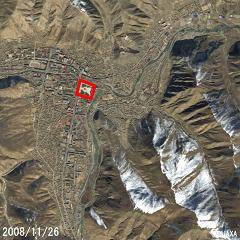
Yushu - before earthquake (SPOT 2.5m, 26 November 2008)

Yushu - after earthquake (SPOT 2.5m, 16 April 2010)
Yushu Stadium (SPOT)
Yushu Stadium – before earthquake (GoogleMap)
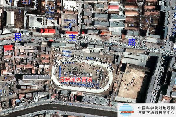
Yushu Stadium – after earthquake (aerial photo with 0.4 m). No obvious damage. Relief shelters are being built.
Gesar Square (SPOT)
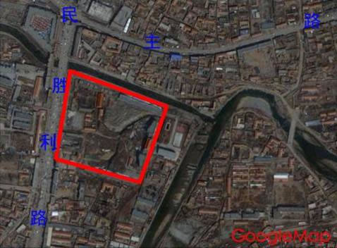
Gesar Square – before earthquake (GoogleMap)
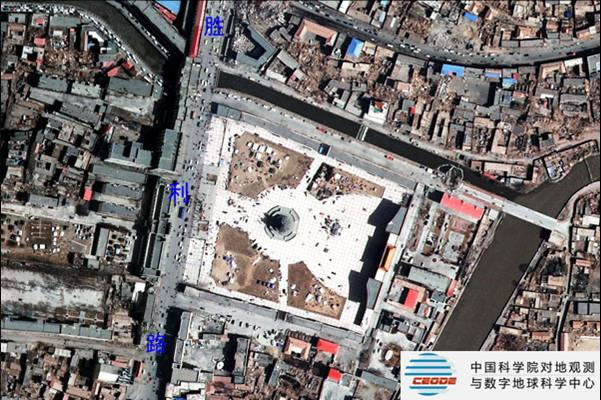
Gesar Square – after earthquake (aerial photo with 0.4 m). Over 80% of the buildings were damaged.
Gyegu Gompa (SPOT)

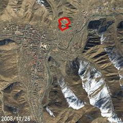
Gyegu Gompa – before earthquake (GoogleMap)
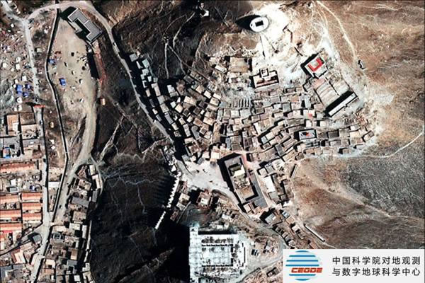
Gyegu Gompa – after earthquake (aerial photo with 0.4 m). Over 40% of the buildings were damaged.
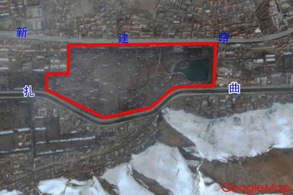
Yushu Park – before earthquake (GoogleMap)
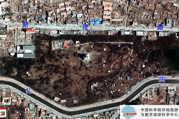
Yushu Park – after earthquake (aerial photo with 0.4 m). Over 80% of the buildings were damaged.
Gyanamani temple – before earthquake (GoogleMap)
Gyanamani temple – after earthquake (aerial photo with 0.4 m). Buildings were slightly damaged.
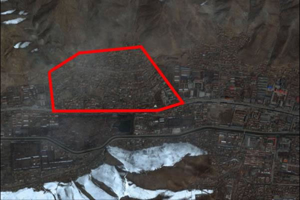
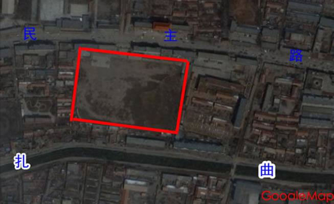
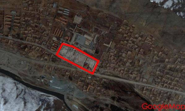
Seriously damaged area – before earthquake (GoogleMap)
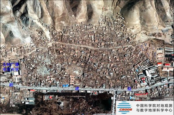
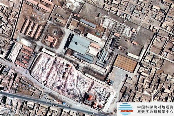
Seriously damaged area – after earthquake (aerial photo with 0.4 m). Over 80% of the buildings were damaged.