

CUHK
News Centre
CUHK ISEIS Assists AFCD in Assessing Carrying Capacity for Aquaculture in Hong Kong Coastal Water
A research team led by Prof. Pan Jiayi of the Institute of Space and Earth Information Science (ISEIS) of The Chinese University of Hong Kong (CUHK) has developed a forecast system for coastal marine dynamic environments. It aims to assist the Agriculture, Fisheries and Conservation Department (AFCD) of the HKSAR Government in analysing the carrying capacity of the Hong Kong coastal regime, with a view to providing the local aquaculture industry with useful information. The development of the system was supported by the Hong Kong Government’s Innovation and Technology Fund.
Hong Kong is surrounded by the sea on three sides. The dynamics of nearby coastal environments are important to the economic and social development of the region. In particular, the carrying capacity of coastal waters is an important parameter for the sustainable development of nearshore mariculture. The forecast system provides the AFCD with current field data at high spatial resolution in Hong Kong’s aquaculture areas. It assists the AFCD in assessing the carrying capacity of aquaculture areas of Hong Kong and in understanding how water currents and mixing influence the variations of key biochemical parameters such as nutrients and dissolved oxygen. It can predict coastal currents up to 72 hours in advance, at the highest possible spatial resolution of 50 m. Through this information, the AFCD can analyse the carrying capacity of coastal mariculture environment and encourage aquaculture in a scientific and reasonable manner, in order to ensure the sustainable development of the coastal mariculture industry.
Professor Pan said that the research team has made significant progress in the hydrodynamic predictions of the Hong Kong coastal waters. The next step would be the assimilation of numerical prediction models with in-situ observations, which would substantially improve the accuracy of predictions, as well as the development of an advanced user-friendly interface for the forecast system, so that the system could be used more widely and easily in the near future.
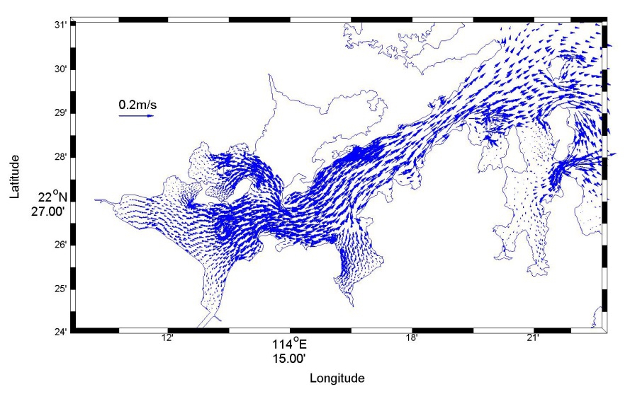
The forecast system for coastal marine dynamic environments shows the surface ocean current in the Tolo Harbour.