
CUHK
News Centre
CUHK Institute of Space and Earth Information Science Uses Satellite Remote Sensing Technology to Monitor Offshore Oil Pollution
The oil spill in the Gulf of Mexico could turn into the most serious marine pollution ever. In fact, there are many oil drilling facilities in the South China Sea, posing a potential threat to the coastal environment of Hong Kong and South China.
To deal with possible emergencies, the Institute of Space and Earth Information Science (ISEIS) of The Chinese University of Hong Kong (CUHK) uses satellite remote sensing technology to carry out oil pollution monitoring research for the coastal region of Hong Kong and the South China Sea. ISEIS’s Satellite Remote Sensing Ground Receiving Station is a national environmental monitoring platform supported by the State Ministry of Science and Technology and the Innovation and Technology Commission of the HKSAR Government. Since 2007, the Satellite Station has conducted systematic environmental monitoring over the South China Sea and captured more than 1,600 scenes of all-weather satellite images over the region. For example, the Satellite Station spotted an oil spill of 80 km long around 300 km away from Hong Kong in March 2008 (see images). The analysis was sent to the State Oceanic Administration for immediate follow-ups.
ISEIS is developing a forecast system for dispersion of marine pollutants and risk assessment. ‘Marine oil pollution can cause mass mortality of marine lives and destruct natural environments of the ocean. Drawing reference from the real-time monitoring data from satellite observations, the forecast system developed by the ISEIS can predict dispersion and draft paths of leaked oil spills over the sea. The results will help the fishery industry, government, and environment protection agencies to conduct quick risk assessments and formulate an appropriate fast response plan to minimize losses caused by marine oil pollutions,’ said Prof. Pan Jiayi, principal investigator of the project.
‘At present, ISEIS is seeking resources to build a backup facility for the antenna system and further enhance the integration of space- and ground-based environmental monitoring network in Hong Kong and the Pearl River Delta. These improvements will provide timely monitoring and better protection to the ocean environment of Hong Kong and the nearby regions,’ remarked Prof. Lin Hui, Director of ISEIS.
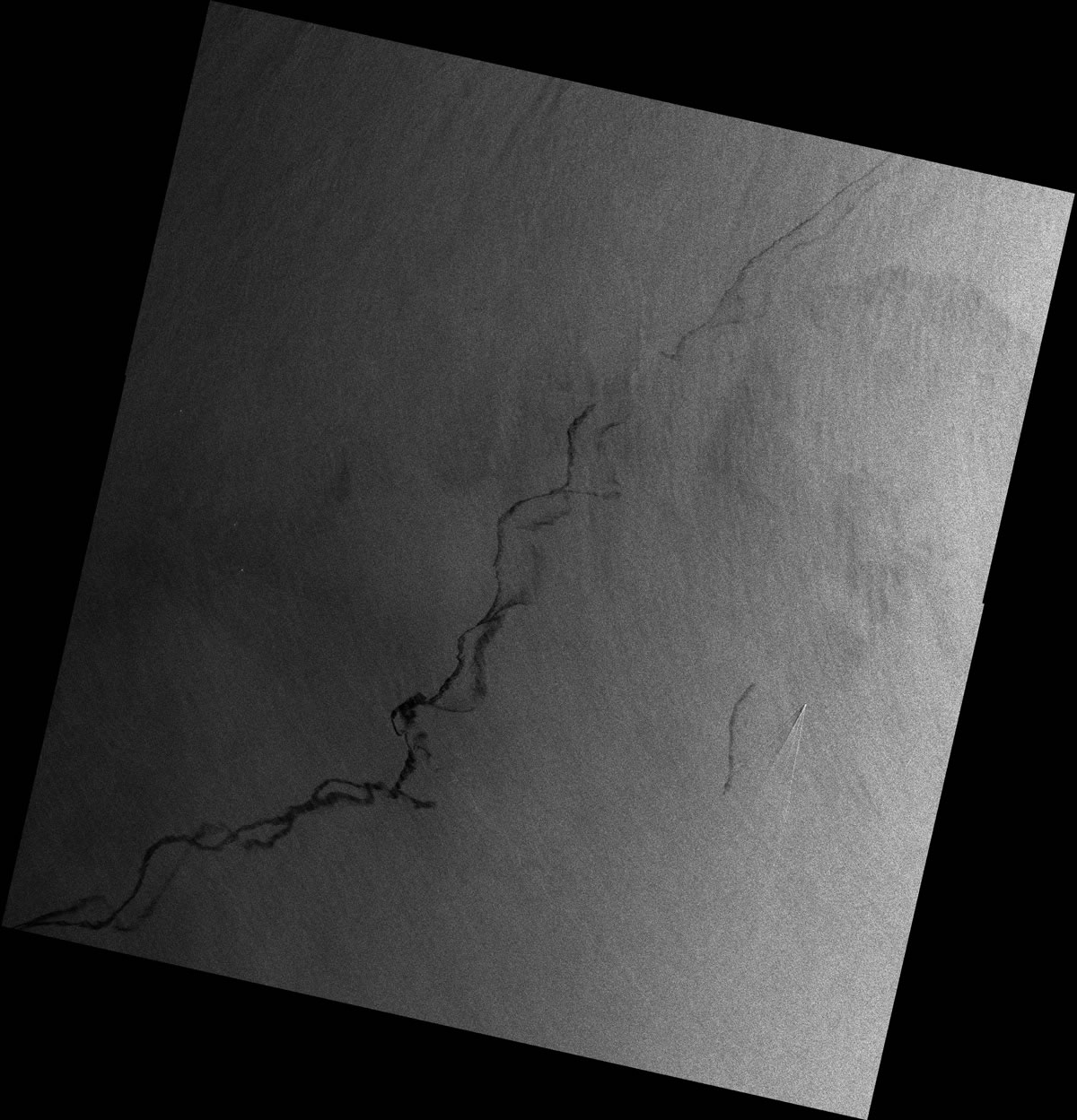
The CUHK Satellite Station captured a satellite image on 27 March 2008, which shows the oil spill around 300 km away from Hong Kong
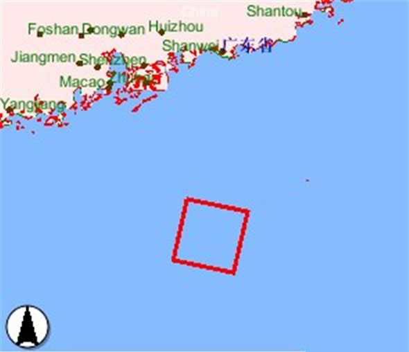
A map indicating the location of the satellite image